Today, we have published our third
Geological Mapwork from scratch activity. This one investigates a
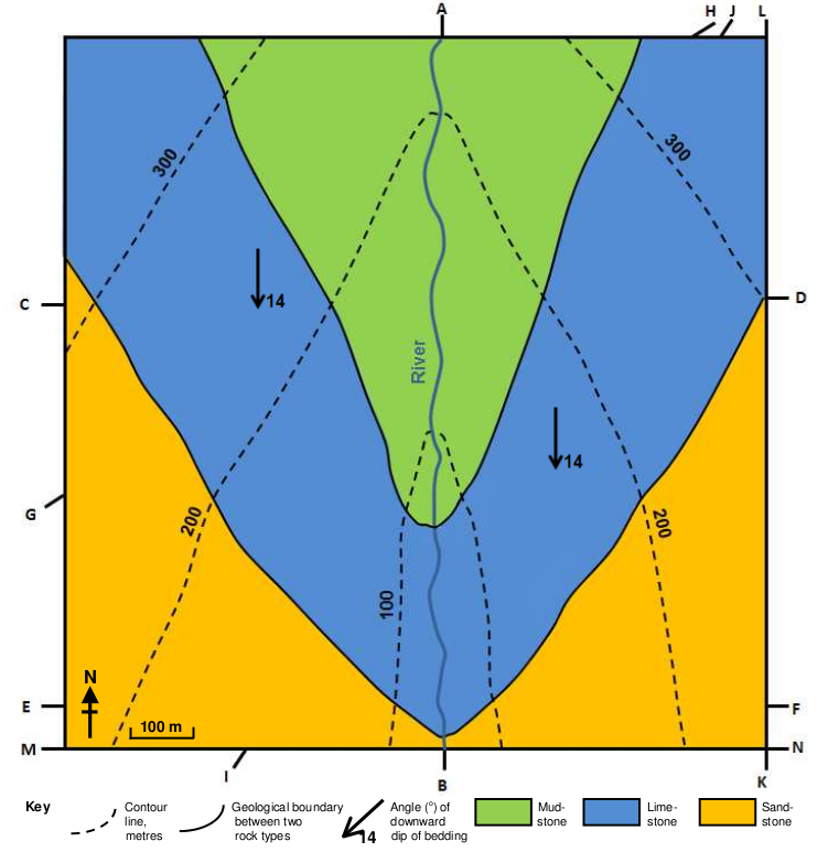
valley with dipping geology. Pupils will be able to draw their own cross sections and 3D models. They are shown a photograph of a straight valley and are then given a simple geological map of such a landform, with beds dipping towards the south. They are also encouraged to use the British Geological Survey's
OpenGeoscience maps - instructions for doing this are given.
The drawing of these topographical and geological cross sections involves spatial thinking skills. The more complex the cross sections become, the more spatial interpretation is needed, including interpolation and extrapolation skills.
This latest activity is one of many that can be found on our
website.
1 comment:
Useful...Thank you..!
Post a Comment